Remote Sensing Solutions
Airborne Technologies Incorporated has been developing innovative remote sensing and survey solutions for over twenty years. ATI is dedicated to providing the military and scientific communities with flexible and affordable unmanned aircraft, autopilots, and related systems. We listen carefully to our customers for their feedback is critical to achieving our goal of efficient, effective and easily employed products. ATI also provides consulting and training services to UAS developers.
Background
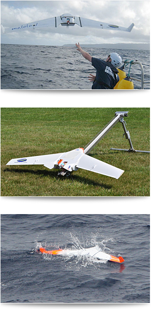
Since 1987 ATI has contributed to commercial fishing and marine debris research projects and have flown over 6000 hours of near-shore ocean surveys. ATI was the project management team for the High Seas GhostNet Project. This NASA and NOAA funded project utilized ocean modeling, satellite and airborne remote sensing and in-situ buoys to locate and track concentrations of marine debris in the open ocean. During the course of this project, ATI was asked to take the lead on the development of a small drifter buoy that could be used to tag and track derelict fishing gear in the open ocean. This project led to the development of a small, marinized UAS to explore the potential of identifying marine debris at sea. With roots in research and movement into broader markets, ATI is dedicated to the development of systems that help your missions succeed.
Expertise
ATI team members possess a wide range of professional expertise, including:
- 10 years of UAS Development
- Satellite-based Asset Tracking and Monitoring
- Flight Simulation Software Development
- Marine Debris Monitoring and Survey
- Near-shore Ocean Aerial Survey
- Aerial Mapping
- Computer Control Systems Design

